Federal land policy in Iowa
This article does not contain the most recently published data on this subject. If you would like to help our coverage grow, consider donating to Ballotpedia.
| Public Policy |
|---|
| State environmental policy |
Federal land policy involves the ownership and management of land owned by the federal government. As of 2012, the federal government owned between 635 million to 640 million acres, or 28 percent, of the 2.27 billion acres of land in the United States. Federal land is managed for many purposes, such as the conservation and development of natural resources, grazing and recreation. As of 2012, the federal government owned 0.34 percent of Iowa's total land, 122,603 acres out of 35,860,480 total acres.
Land ownership
- See also: Federal land policy and Federal land ownership by state
The federal government owned between 635 million and 640 million acres of land in 2012 (about 28 percent) of the 2.27 billion acres of land in the United States. Around 52 percent of federally owned acres are in 12 Western states—including Alaska, 61 percent of which is federally owned. In contrast, the federal government owns 4 percent of land in the other 38 states. Federal land policy is designed to manage minerals, oil and gas resources, timber, wildlife and fish, and other natural resources found on federal land. Land management policies are highly debated for their economic, environmental and social impacts. Additionally, the size of the federal estate and the acquisition of more federal land are major issues.[1][2]
According to the Congressional Research Service, Iowa spans 35.86 million acres. Of that total, 0.34 percent, or 122,603 million acres, belonged to the federal government as of 2012. More than 35.7 million acres in Iowa are not owned by the federal government, or 11.56 non-federal acres per capita. From 1990 to 2010, the federal government's land ownership in Iowa increased by 89,356 acres.[1]
The table below shows federal land ownership in Iowa compared to its neighbor, Minnesota, and a Western state, Idaho. The [[U.S. Fish and Wildlife Service, which manages endangered species, owned the majority of federal land in Iowa (70,564 acres) compared to 483,787 acres in Minnesota and 48,947 acres in Idaho.
| Federal land ownership in Iowa and other states by agency | |||||||||||
|---|---|---|---|---|---|---|---|---|---|---|---|
| State | |||||||||||
| Agency | Iowa | Minnesota | Idaho | ||||||||
| Acres owned | Percentage owned | Acres owned | Percentage owned | Acres owned | Percentage owned | ||||||
| U.S. Forest Service | 0 | 0.00% | 2,841,630 | 81.91% | 20,465,014 | 62.71% | |||||
| U.S. National Park Service | 2,708 | 2.21% | 139,570 | 4.02% | 507,585 | 1.56% | |||||
| U.S. Fish and Wildlife Service | 70,564 | 57.55% | 483,787 | 13.95% | 48,947 | 0.15% | |||||
| U.S. Bureau of Land Management | 0 | 0.00% | 1,447 | 0.04% | 11,610,111 | 35.57% | |||||
| U.S. Department of Defense | 49,331 | 40.24% | 2,777 | 0.08% | 4,178 | 0.01% | |||||
| Total federal land | 122,603 | 100% | 3,469,211 | 100% | 32,635,835 | 100.00% | |||||
| Source: Congressional Research Service, "Federal Land Ownership: Overview and Data" | |||||||||||
Land usage
Recreation
National parks in Iowa

Iowa has two National Park Service units, one national monument, one national historic site and two national historic trails. A study by the U.S. National Park Service found that 199,993 visitors attended Iowa's national parks and monuments and generated $11.4 million in visitor spending in 2013.[3]

State recreation lands
The table below contains a list of all state parks, forests and recreation areas in Iowa.[4]
| State parks in Iowa | ||||||
|---|---|---|---|---|---|---|
| State park name | ||||||
| Ambrose A. Call State Park | ||||||
| Backbone State Park | ||||||
| Badger Creek State Recreation Area | ||||||
| Banner Lakes at Summerset State Park | ||||||
| Beed's Lake State Park | ||||||
| Bellevue State Park | ||||||
| Big Creek State Park | ||||||
| Black Hawk State Park | ||||||
| Brushy Creek State Recreation Area | ||||||
| Cedar Rock | ||||||
| Clear Lake State Park | ||||||
| Dolliver Memorial State Park | ||||||
| Elinor Bedell State Park | ||||||
| Elk Rock State Park | ||||||
| Emerson Bay State Recreation Area | ||||||
| Fairport State Recreation Area | ||||||
| Fort Atkinson State Preserve | ||||||
| Fort Defiance State Park | ||||||
| Geode State Park | ||||||
| George Wyth State Park | ||||||
| Green Valley State Park | ||||||
| Gull Point State Park | ||||||
| Honey Creek Resort | ||||||
| Honey Creek State Park | ||||||
| Lacey Keosauqua State Park | ||||||
| Lake Ahquabi State Park | ||||||
| Lake Anita State Park | ||||||
| Lake Darling State Park | ||||||
| Lake Keomah State Park | ||||||
| Lake Macbride State Park | ||||||
| Lake Manawa State Park | ||||||
| Lake of Three Fires State Park | ||||||
| Lake Wapello State Park | ||||||
| Ledges State Park | ||||||
| Lewis and Clark State Park | ||||||
| Lower Gar State Recreation Area | ||||||
| Maquoketa Caves State Park | ||||||
| Marble Beach State Recreation Area | ||||||
| McIntosh Woods State Park | ||||||
| Mines of Spain State Recreation Area and E. B. Lyons Interpretive Center | ||||||
| Mini-Wakan State Park | ||||||
| Nine Eagles State Park | ||||||
| Okamanpedan State Park | ||||||
| Palisades-Kepler State Park | ||||||
| Pikes Peak State Park | ||||||
| Pikes Point State Park | ||||||
| Pilot Knob State Park | ||||||
| Pine Lake State Park | ||||||
| Pleasant Creek State Recreation Area | ||||||
| Prairie Rose State Park | ||||||
| Preparation Canyon State Park | ||||||
| Red Haw State Park | ||||||
| Rice Lake State Park | ||||||
| Rock Creek State Park | ||||||
| Shimek State Forest | ||||||
| Springbrook State Park | ||||||
| Stephens State Forest | ||||||
| Stone State Park | ||||||
| Templar State Recreation Area | ||||||
| Trapper's Bay State Park | ||||||
| Twin Lakes State Park | ||||||
| Union Grove State Park | ||||||
| Viking Lake State Park | ||||||
| Volga River State Recreation Area | ||||||
| Walnut Woods State Park | ||||||
| Wapsipinicon State Park | ||||||
| Waubonsie State Park | ||||||
| Wildcat Den State Park | ||||||
| Wilson Island State Recreation Area | ||||||
| Yellow River State Forest | ||||||
Economic activity on federal lands
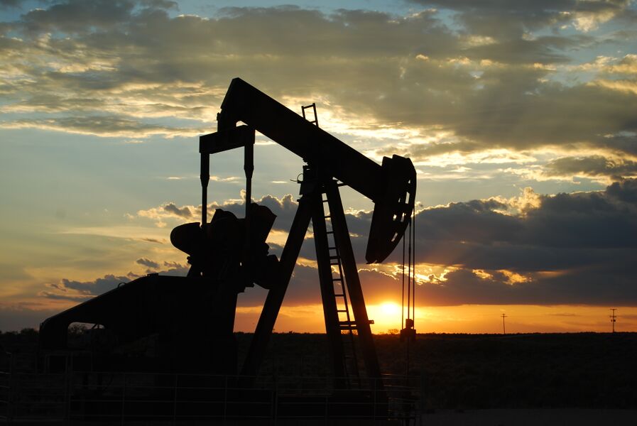
Oil and gas activity
- See also: BLM oil and gas leases by state
Private mining companies, including oil and natural gas companies, can apply for leases from the U.S. Bureau of Land Management (BLM) to explore and produce energy on federal land. The company seeking a lease must nominate the land for oil and gas exploration to the BLM, which evaluates and approves the lease. The BLM state offices make leasing decisions based on their land use plans, which contain information on the land's resources and the potential environmental impact of oil or gas exploration. If federal lands are approved for leasing, the BLM requires an application from the company containing information on how the exploration, drilling and production will be conducted. Afterward, the BLM will produce an environmental analysis and a list of requirements before work on the land can begin. The agency also inspects the companies' drilling and producing on the leased lands.[5]
In 2013, there were 47,427 active leases covering 36.09 million acres of federal land nationwide. Of that total, no leases were in Iowa. In 2013, out of 3,770 new drilling leases approved nationwide by the BLM for oil and gas exploration, no leases were in Iowa.[6][7][8][9][10]
The table below shows how Iowa compared to neighboring states in oil and gas permits on BLM-managed lands in 2013. Iowa had no active leases or acres under lease in 2013.
| Oil and gas leasing on BLM lands by state | ||||
|---|---|---|---|---|
| State | Active permits on BLM lands (FY 2013) | Total acres under lease (FY 2013) | State percentage of total permits | State percentage of total acres |
| Iowa | 0 | 0 | 0.00% | 0.00% |
| Illinois | 9 | 1,651 | 0.02% | 0.00% |
| Minnesota | 0 | 0 | 0.00% | 0.00% |
| Missouri | 0 | 0 | 0.00% | 0.00% |
| Total United States | 47,427 permits | 36,092,482 acres | - | - |
| Source: U.S. Bureau of Land Management, "Oil and Gas Statistics" | ||||
Payments in lieu of taxes
- See also: Payments in lieu of taxes
Since local governments cannot collect taxes on federally owned property, the U.S. Department of the Interior issues payments to local governments to replace lost property tax revenue from federal land. The payments, known as "Payments in Lieu of Taxes" (PILTs), are typically used for funding services such as fire departments, police protection, school construction and roads.[11]
The table below shows PILTs for Iowa compared to neighboring states between 2011 and 2013. Iowa received the fewest PILTs in 2013 compared to neighboring states.
| Total PILTs for Iowa and neighboring states | ||||||
|---|---|---|---|---|---|---|
| State | FY 2011 | FY 2012 | FY 2013 | State's percentage of 2013 total | ||
| Iowa | $455,637 | $466,912 | $453,945 | 0.11% | ||
| Illinois | $1,111,152 | $1,140,801 | $1,119,970 | 0.28% | ||
| Minnesota | $1,808,191 | $1,944,085 | $1,974,972 | 0.49% | ||
| Missouri | $2,546,022 | $2,736,800 | $3,079,132 | 0.77% | ||
| Source: U.S. Department of the Interior, "PILT" | ||||||
Environmental policy in the 50 states
Click on a state below to read more about that state's energy policy.
See also
External links
Footnotes
- ↑ 1.0 1.1 Congressional Research Service, "Federal Land Ownership: Overview and Data," accessed September 15, 2014
- ↑ U.S. Congressional Research Service, "Federal Lands and Natural Resources: Overview and Selected Issues for the 113th Congress," December 8, 2014
- ↑ U.S. National Park Service, "2013 National Park Visitor Spending Effects Report," accessed October 14, 2014
- ↑ Iowa Department of Natural Resources, "Iowa State Parks and Preserves," accessed December 18, 2014
- ↑ U.S. Bureau of Land Management, "Oil and Gas Lease Sales," accessed October 20, 2014
- ↑ U.S. Bureau of Land Management, "Number of Acres Leased During the Fiscal Year," accessed October 20, 2014
- ↑ U.S. Bureau of Land Management, "Total Number of Leases in Effect," accessed October 20, 2014
- ↑ U.S. Bureau of Land Management, "Summary of Onshore Oil and Gas Statistics," accessed October 20, 2014
- ↑ U.S. Bureau of Land Management, "Number of Drilling Permits Approved by Fiscal Year on Federal Lands," accessed October 20, 2014
- ↑ U.S. Bureau of Land Management, "Total Number of Acres Under Lease As of the Last Day of the Fiscal Year," accessed October 22, 2014
- ↑ U.S. Department of the Interior, "PILT," accessed October 4, 2014
| |||||||||||