Federal land policy in Texas
This article does not contain the most recently published data on this subject. If you would like to help our coverage grow, consider donating to Ballotpedia.
| Public Policy |
|---|
| State environmental policy |
Federal land policy involves the ownership and management of land owned by the federal government. As of 2012, the federal government owned between 635 million to 640 million acres, or 28 percent, of the 2.27 billion acres of land in the United States. Federal land is managed for many purposes, such as the conservation and development of natural resources, grazing and recreation. As of 2012, the federal government owned 1.77 percent of Texas's total land, 2,977,950 acres out of 168,217,600 total acres.
Land ownership
- See also: Federal land policy and Federal land ownership by state
The federal government owned between 635 million and 640 million acres of land in 2012 (about 28 percent) of the 2.27 billion acres of land in the United States. Around 52 percent of federally owned acres were in 12 Western states—including Alaska, 61 percent of which was federally owned. In contrast, the federal government owned 4 percent of land in the other 38 states. Federal land policy is designed to manage minerals, oil and gas resources, timber, wildlife and fish, and other natural resources found on federal land. Land management policies are highly debated for their economic, environmental and social impacts. Additionally, the size of the federal estate and the acquisition of more federal land are major issues.[1][2]
According to the Congressional Research Service, Texas spans 168.2 million acres. Of that total, 1.7 percent, or 2.97 million acres, belonged to the federal government as of 2012. More than 167 million acres in Texas are not owned by the federal government, or 6.34 non-federal acres per capita. From 1990 to 2010, the federal government's land ownership in Texas increased by 326,275 acres.[1]
The table below shows federal land ownership in Texas compared to two neighboring states, New Mexico and Oklahoma. Texas had less federal land than New Mexico but more Oklahoma. More than 40 percent of federal land in Texas was owned by the U.S. Forest Service compared to 1.4 percent in New Mexico and 1.42 percent in Oklahoma. The U.S. National Park Service owned more than 1.2 million acres in Texas compared to 376,849 acres in New Mexico and 10,008 acres in Oklahoma.
| Federal land owned in Texas and neighboring states by federal agency | |||||||||||
|---|---|---|---|---|---|---|---|---|---|---|---|
| State | |||||||||||
| Agency | Texas | New Mexico | Oklahoma | ||||||||
| Acres owned | Percentage owned | Acres owned | Percentage owned | Acres owned | Percentage owned | ||||||
| U.S. Forest Service | 755,365 | 25.37% | 9,417,975 | 34.88% | 400,928 | 57.00% | |||||
| U.S. National Park Service | 1,201,670 | 40.35% | 376,849 | 1.40% | 10,008 | 1.42% | |||||
| U.S. Fish and Wildlife Service | 527,418 | 17.71% | 327,264 | 1.21% | 106,594 | 15.16% | |||||
| U.S. Bureau of Land Management | 11,833 | 0.40% | 13,484,405 | 49.94% | 1,975 | 0.28% | |||||
| U.S. Department of Defense | 481,664 | 16.17% | 3,395,090 | 12.57% | 183,831 | 26.14% | |||||
| Total federal land | 2,977,950 | 100% | 27,001,583 | 100% | 703,336 | 100% | |||||
| Source: Congressional Research Service, "Federal Land Ownership: Overview and Data" | |||||||||||
Land usage
Recreation
National parks in Texas
Texas has 13 National Park Service units, one national monument, three national forests, six wilderness areas, two national recreation areas, one national historic site, and one national historic trail. A study by the U.S. National Park Service found that 3.4 million peopled visited Texas's national parks and monuments and generated $173.4 million in visitor spending in 2013.[3]
State recreation lands
There are 103 state parks in Texas, which are listed in the table below.[4]
| State parks in Texas | ||||||
|---|---|---|---|---|---|---|
| State park name | ||||||
| Abilene State Park | ||||||
| Atlanta State Park | ||||||
| Balmorhea State Park | ||||||
| Barton Warnock Visitor Center | ||||||
| Bastrop State Park | ||||||
| Battleship Texas State Historic Site | ||||||
| Bentsen-Rio Grande Valley State Park | ||||||
| Big Bend Ranch State Park | ||||||
| Big Spring State Park | ||||||
| Blanco State Park | ||||||
| Bonham State Park | ||||||
| Brazos Bend State Park | ||||||
| Buescher State Park | ||||||
| Caddo Lake State Park | ||||||
| Caprock Canyons State Park | ||||||
| Caprock Canyons Trailway | ||||||
| Cedar Hill State Park | ||||||
| Choke Canyon State Park - Calliham Unit | ||||||
| Choke Canyon State Park - South Shore Unit | ||||||
| Cleburne State Park | ||||||
| Colorado Bend State Park | ||||||
| Cooper Lake State Park - Doctors Creek Unit | ||||||
| Cooper Lake State Park - South Sulphur Unit | ||||||
| Copper Breaks State Park | ||||||
| Daingerfield State Park | ||||||
| Davis Mountains State Park | ||||||
| Devil`s Sinkhole State Natural Area | ||||||
| Devils River State Natural Area | ||||||
| Dinosaur Valley State Park | ||||||
| Eisenhower State Park | ||||||
| Enchanted Rock State Natural Area | ||||||
| Estero Llano Grande State Park | ||||||
| Fairfield Lake State Park | ||||||
| Falcon State Park | ||||||
| Fanthorp Inn State Historic Site | ||||||
| Fort Boggy State Park | ||||||
| Fort Leaton State Historic Site | ||||||
| Fort Parker State Park | ||||||
| Fort Richardson State Park & Historic Site / Lost Creek Reservoir State Trailway | ||||||
| Franklin Mountains State Park | ||||||
| Galveston Island State Park | ||||||
| Garner State Park | ||||||
| Goliad State Park & Historic Site | ||||||
| Goose Island State Park | ||||||
| Government Canyon State Natural Area | ||||||
| Guadalupe River State Park | ||||||
| Hill Country State Natural Area | ||||||
| Honey Creek State Natural Area | ||||||
| Hueco Tanks State Park & Historic Site | ||||||
| Huntsville State Park | ||||||
| Indian Lodge | ||||||
| Inks Lake State Park | ||||||
| Kickapoo Cavern State Park | ||||||
| Lake Arrowhead State Park | ||||||
| Lake Bob Sandlin State Park | ||||||
| Lake Brownwood State Park | ||||||
| Lake Casa Blanca International State Park | ||||||
| Lake Colorado City State Park | ||||||
| Lake Corpus Christi State Park | ||||||
| Lake Livingston State Park | ||||||
| Lake Mineral Wells State Park | ||||||
| Lake Mineral Wells Trailway | ||||||
| Lake Somerville State Park - Birch Creek Unit | ||||||
| Lake Somerville State Park - Nails Creek Unit | ||||||
| Lake Tawakoni State Park | ||||||
| Lake Whitney State Park | ||||||
| Lipantitlan State Historic Site | ||||||
| Lockhart State Park | ||||||
| Longhorn Cavern State Park | ||||||
| Lost Maples State Natural Area | ||||||
| Lyndon B. Johnson State Park & Historic Site | ||||||
| Martin Creek Lake State Park | ||||||
| Martin Dies, Jr. State Park | ||||||
| Mckinney Falls State Park | ||||||
| Meridian State Park | ||||||
| Mission Rosario State Historic Site | ||||||
| Mission Tejas State Park | ||||||
| Monahans Sandhills State Park | ||||||
| Monument Hill & Kreische Brewery State Historic Site | ||||||
| Mother Neff State Park | ||||||
| Mustang Island State Park | ||||||
| Old Tunnel State Park | ||||||
| Palmetto State Park | ||||||
| Palo Duro Canyon State Park | ||||||
| Pedernales Falls State Park | ||||||
| Port Isabel Lighthouse State Historic Site | ||||||
| Possum Kingdom State Park | ||||||
| Purtis Creek State Park | ||||||
| Ray Roberts Lake State Park - Isle du Bois Unit | ||||||
| Ray Roberts Lake State Park - Johnson Branch Unit | ||||||
| Resaca de la Palma State Park | ||||||
| San Angelo State Park | ||||||
| San Jacinto Battleground State Historic Site | ||||||
| Sea Rim State Park | ||||||
| Seminole Canyon State Park & Historic Site | ||||||
| Sheldon Lake State Park & Environmental Learning Center | ||||||
| South Llano River State Park | ||||||
| Stephen F. Austin State Park | ||||||
| Tyler State Park | ||||||
| Village Creek State Park | ||||||
| Washington-on-the-Brazos State Historic Site | ||||||
| Wyler Aerial Tramway | ||||||
| Zaragoza Birthplace State Historic Site | ||||||
| Source: Texas Parks and Wildlife, "State Parks" | ||||||

Economic activity on federal lands
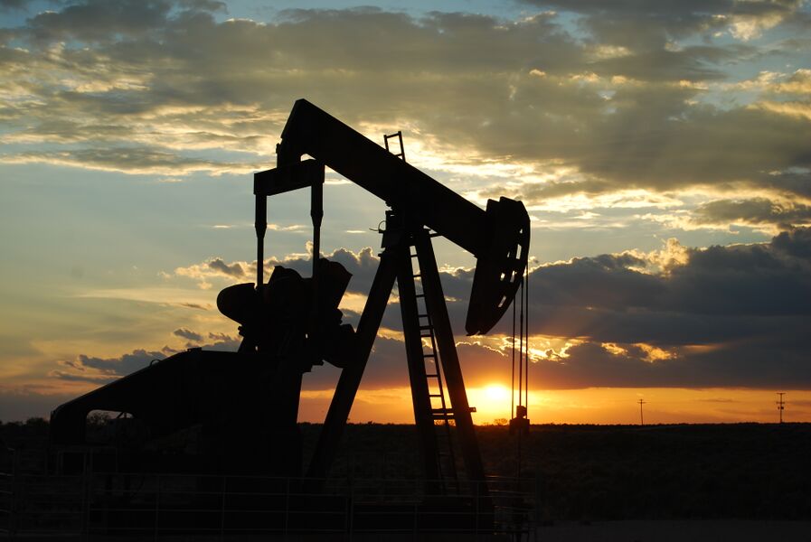
Oil and gas activity
- See also: BLM oil and gas leases by state
Private mining companies, including oil and natural gas companies, can apply for leases from the U.S. Bureau of Land Management (BLM) to explore and produce energy on federal land. The company seeking a lease must nominate the land for oil and gas exploration to the BLM, which evaluates and approves the lease. The BLM state offices make leasing decisions based on their land use plans, which contain information on the land's resources and the potential environmental impact of oil or gas exploration. If federal lands are approved for leasing, the BLM requires information about how the company will conduct its drilling and production. Afterward, the BLM will produce an environmental analysis and a list of requirements before work on the land can begin. The agency also inspects the companies' drilling and production on the leased lands.[5]
In 2013, there were 47,427 active leases covering 36.09 million acres of federal land nationwide. Of that total, 683 leases (1.44 percent of all leases), covering 415,181 acres (1.15 percent of all leased land in 2013), were in Texas. In 2013, out of 3,770 new drilling leases approved nationwide by the BLM for oil and gas exploration, 965 leases (25.5 percent) were in Texas.[6][7][8][9][10]
The table below shows how Texas compared to neighboring states in oil and gas permits on BLM-managed lands in 2013. Texas had more active leases than Louisiana but fewer than New Mexico and Oklahoma. Texas had 415,181 acres under lease in 2013, which was more than Louisiana and Oklahoma but fewer than New Mexico.
| Oil and gas leasing on BLM lands by state | ||||
|---|---|---|---|---|
| State | Active permits on BLM lands (FY 2013) | Total acres under lease (FY 2013) | State percentage of total permits | State percentage of total acres |
| Texas | 683 | 415,181 | 1.44% | 1.15% |
| Louisiana | 525 | 297,028 | 1.11% | 0.82% |
| New Mexico | 8,348 | 4,819,205 | 17.60% | 13.35% |
| Oklahoma | 1,284 | 321,757 | 2.71% | 0.89% |
| Total United States | 47,427 permits | 36,092,482 acres | - | - |
| Source: U.S. Bureau of Land Management, "Oil and Gas Statistics" | ||||
Payments in lieu of taxes
- See also: Payments in lieu of taxes
Since local governments cannot collect taxes on federally owned property, the U.S. Department of the Interior issues payments to local governments to replace lost property tax revenue from federal land. The payments, known as "Payments in Lieu of Taxes" (PILTs), are typically used for funding services such as fire departments, police protection, school construction and roads.[11]
The table below shows PILTs for Texas compared to neighboring states between 2011 and 2013. Texas received more PILTs in 2013 than Louisiana and Oklahoma but fewer than New Mexico.
| Total PILTs for Texas and neighboring states | ||||||
|---|---|---|---|---|---|---|
| State | FY 2011 | FY 2012 | FY 2013 | State's percentage of 2013 total | ||
| Texas | $4,629,597 | $4,644,653 | $4,803,981 | 1.20% | ||
| Louisiana | $554,343 | $609,979 | $634,317 | 0.16% | ||
| New Mexico | $32,916,396 | $34,805,383 | $34,692,967 | 8.64% | ||
| Oklahoma | $2,639,362 | $2,740,199 | $2,794,607 | 0.70% | ||
| Source: U.S. Department of the Interior, "PILT" | ||||||
Environmental policy in the 50 states
Click on a state below to read more about that state's energy policy.
See also
External links
Footnotes
- ↑ 1.0 1.1 Congressional Research Service, "Federal Land Ownership: Overview and Data," accessed September 15, 2014
- ↑ U.S. Congressional Research Service, "Federal Lands and Natural Resources: Overview and Selected Issues for the 113th Congress," December 8, 2014
- ↑ U.S. National Park Service, "2013 National Park Visitor Spending Effects Report," accessed October 14, 2014
- ↑ Texas Parks and Wildlife, "All State Parks," accessed November 19, 2014
- ↑ U.S. Bureau of Land Management, "Oil and Gas Lease Sales," accessed October 20, 2014
- ↑ U.S. Bureau of Land Management, "Number of Acres Leased During the Fiscal Year," accessed October 20, 2014
- ↑ U.S. Bureau of Land Management, "Total Number of Leases in Effect," accessed October 20, 2014
- ↑ U.S. Bureau of Land Management, "Summary of Onshore Oil and Gas Statistics," accessed October 20, 2014
- ↑ U.S. Bureau of Land Management, "Number of Drilling Permits Approved by Fiscal Year on Federal Lands," accessed October 20, 2014
- ↑ U.S. Bureau of Land Management, "Total Number of Acres Under Lease As of the Last Day of the Fiscal Year," accessed October 22, 2014
- ↑ U.S. Department of the Interior, "PILT," accessed October 4, 2014
| |||||||||||