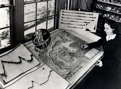
Tharp, entre 1948 et 1950, avec une carte sous-marine sur son bureau. Des profils sonar enroulés du fond océanique sont posés sur l’étagère derrière elle.
Observatoire terrestre Lamont-Doherty et succession de Marie Tharp
La géologue et cartographe américaine Marie Tharp (1920-2006) a révolutionné la conception scientifique du fond océanique, en montrant que ce n’était pas une surface plane ni uniforme.
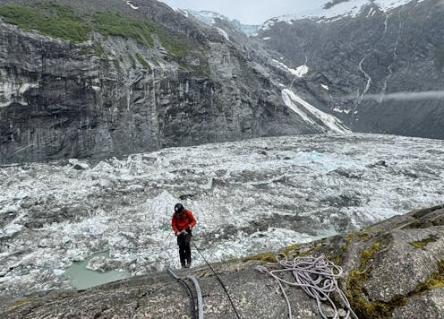
U.S. Geological Survey staff check monitoring equipment in Suicide Basin in June 2025. By August, the basin had filled with meltwater.
Jeff Conaway/U.S. Geological Survey
Suicide Basin, an ice-dammed lake on an arm of Mendenhall Glacier, has filled up with meltwater and sent destructive surges of water into Juneau for 3 straight summers.
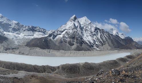
O Lago Imja, um enorme lago glacial na região do Monte Everest, no Nepal, começou como pequenas lagoas de água de degelo em 1962 e agora contém 90 milhões de metros cúbicos de água, volume que já foi reduzido numa tentativa de proteger as comunidades a jusante.
Alton Byers
Quando o permafrost das montanhas descongela e as geleiras derretem, os lagos glaciais podem se tornar um risco de inundação letal para qualquer pessoa a jusante.
Imja Lake, a glacial lake in the Mount Everest region of Nepal, began as meltwater ponds in 1962 and now contains 90 million cubic meters of water. Its water level was lowered to protect downstream communities.
Alton Byers
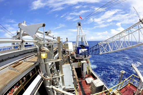
The National Science Foundation says that the JOIDES Resolution has become too costly to fund. But scientists say its $72 million annual budget pales compared with discoveries the ship has enabled.
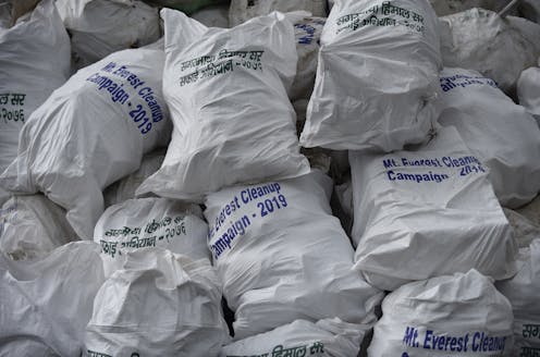
Trash collected in a 2019 cleanup that removed 24,000 pounds (10,000 kilograms) of garbage from Mount Everest.
Narayan Maharjan/NurPhoto via Getty Images
Mulai dari kepiting berbulu yang mengenakan topi spons laut hingga cacing yang bersinar dalam gelap, para ilmuwan terus menemukan bentuk kehidupan baru yang menakjubkan di lautan.
The Rose-veiled fairy wrasse, a small reef fish discovered in 2022.
Luiz A. Rocha/Wikimedia Commons
Discover the stories of five trailblazing women – Tharp, Nice, Tu, Noether and Wu – who worked in STEM during the 20th century.
Tube worms, anemones and mussels clustered near a hydrothermal vent on the Galapagos Rift.
NOAA Okeanos Explorer Program, Galapagos Rift Expedition 2011/Flickr
Oceanographer Robert D. Ballard, who is best known for finding the wreck of Titanic, has written a memoir recounting his biggest discoveries and calling for more ocean exploration.
Retour au port du Guilvinec (Finistère) après une journée de pêche.
Shutterstock
L’océan Atlantique continue de s’étendre mais les hommes surexploitent ses ressources, dont l’espèce la plus célèbre – la morue – illustre les ravages de la pêche à outrance.
Kapal memancing memasuki Le Guilvinec, Brittany, Prancis.
Photoneye/Shutterstock
Samudra Atlantik masih berkembang, namun manusia sudah melakukan eksploitasi terhadap sumber daya yang ada. Contoh terkenal untuk kasus overfishing adalah ikan kod di Atlantik Utara.
El Océano Atlántico sigue creciendo físicamente, pero los humanos estamos sobreexplotando sus ricas pesquerías. La especie más famosa -el bacalao del Atlántico Norte- se ha convertido en un ejemplo de libro de sobrepesca perjudicial.
Fishing boats coming into Le Guilvinec, Brittany, France, at the end of the day.
Photoneye/Shutterstock
The Atlantic Ocean is still growing physically, but humans are over-harvesting its rich fisheries. The most famous one – North Atlantic cod – has become a textbook example of harmful overfishing.
Tharp with an undersea map at her desk. Rolled sonar profiles of the ocean floor are on the shelf behind her.
Lamont-Doherty Earth Observatory and the estate of Marie Tharp
Born on July 30, 1920, geologist and cartographer Tharp changed scientific thinking about what lay at the bottom of the ocean – not a featureless flat, but rugged and varied terrain.
Deep Discoverer sedang menangkap gambar sumber hidrotermal baru di barat Pasifik.
NOAA
Di beberapa tempat, lautan bisa sedalam 7 mil. Para ilmuwan mengeksplorasi bawah lautan telah menemukan mahkluk laut yang unik, formasi geologi yang aneh dan mencatat sejarah lautan.
The remotely operated vehicle Deep Discoverer captures images of a newly discovered hydrothermal vent field in the western Pacific.
NOAA
In some places, the ocean is almost 7 miles deep. Scientists exploring the ocean floor have found strange sea creatures, bizarre geologic formations and records of Earth’s history.
The research vessel must dodge dangerous icebergs as it drills for sediment core samples.
Phil Christie/IODP
A paleooceanographer describes her ninth sea expedition, this time retrieving cylindrical ‘cores’ of the sediment and rock that’s as much as two miles down at the ocean floor.
El buque de perforación científica JOIDES Resolution llega a Honolulu después de una exitosa campaña.
IODP / William Crawford c
El suelo oceánico contiene información única sobre la historia de la Tierra. Las perforaciones científicas en los océanos, que comenzaron hace 50 años, han permitido comprender mejor el cambio climático, los riesgos geológicos y las condiciones clave para la vida.
The scientific drilling ship JOIDES Resolution arrives in Honolulu after successful sea trials and testing of scientific and drilling equipment.
IODP
The ocean floor holds unique information about Earth’s history. Scientific ocean drilling, which started 50 years ago, has yielded insights into climate change, geohazards and the key conditions for life.