Tierra Caliente (Mexico)
Tierra Caliente | |
|---|---|
Geographical Region | |
 Churumuco, a central area of the Tierra Caliente | |
 Location of Tierra Caliente in Mexico | |
| Country | Mexico |
Tierra Caliente (Spanish for Hot Land) is a cultural and geographical region in southern Mexico that comprises some low-elevation areas of the states of Michoacán, Guerrero and Mexico. As the name suggests, the region is characterized by a hot climate. The overall precipitation is also low - around 600 mm/year, but can be as low as 400 mm in some low-lying areas of Michoacán and Guerrero.
Municipalities
[edit]Guerrero
[edit]State of Mexico (Edomex)
[edit]| Name | Municipal seat |
|---|---|
| Amatepec | Amatepec |
| Luvianos | Villa Luvianos |
| Sultepec | Sultepec de Pedro Ascencio de Alquisiras |
| Tejupilco | Tejupilco de Hidalgo |
| Tlatlaya | Tlatlaya |
- Apatzingan
- Aguililla
- Tingambato
- Tuzantla
- Susupuato de Guerrero
- Nocupétaro
- Carácuaro
- Tiquicheo
- Huetamo de Nuñez
Gallery
[edit]-
:Catedral de Apatzingán
-
Catedral de San Juan Bautista Pungarabato
-
Iglesia de Zirándaro
-
Iglesia de Cutzamala de Pinzón
-
Iglesia de San Francisco de Asís
-
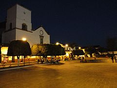
Tacámabro de Codallos
-
Churumuco viejo


Sources
[edit]References
[edit]- Entregan recursos de Codecos a las regiones Oriente y Tierra Caliente. State of Michoacán.
- Acuña, R. (1987). Relaciones Geográficas del Siglo XVI: Michoacán. Universidad Nacional Autónoma de México.
- Gerhard, P. (1972). A Guide to the Historical Geography of New Spain. University of Cambridge Press.
- Sebastian Avellaneda Jr. (2013). Information over San Lucas, Michoacán. Ohio Valley University, WV.